- Email : info@champlainareatrails.com
- Phone : (518) 962-2287
- Address : 6470 Main St., Suite 2 Westport, NY 12993
-
location
Westport, NY 12993
-
Category
Easy-Moderate
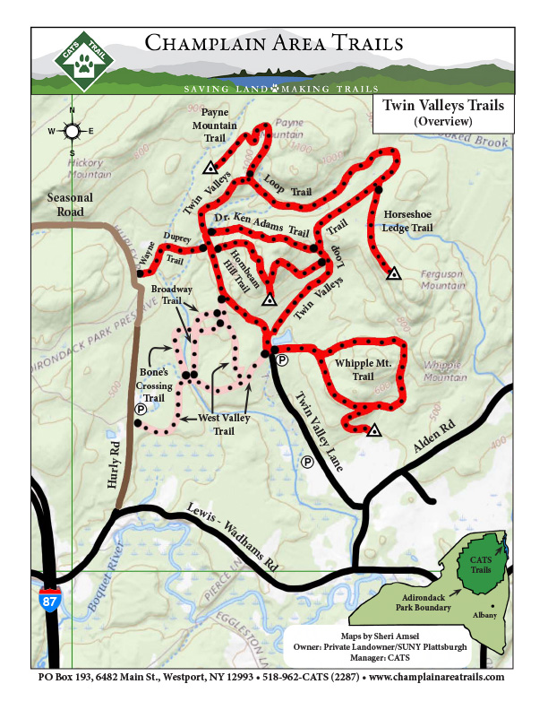
Twin Valleys Trail Network
The property is managed by College Auxiliary Services of SUNY-Plattsburgh. The trails are maintained by Champlain Area Trails.
Description:
Dr. Ken Adams Trail: This is an easy 1.5-mile out-and-back connector trail that allows the hiker to shorten the Twin Valleys Loop.
Bone’s Crossing: This 2-mile out-and-back trail is on the West Valley property and passes through a scenic hemlock valley with a serpentine stream.
Broadway: This lightly maintained 1.5-mile out-and-back, old logging road provides cross-country skiers easy access to the Twin Valley Loop from the West Valley parking lot.
Wayne Dupree Trail: This 1.5-mile out-and-back trail provides another access point to the Twin Valleys property from Hurley Road. The trail follows an old farm road with massive Sugar Maples before following a cascading stream through a mature hemlock forest.
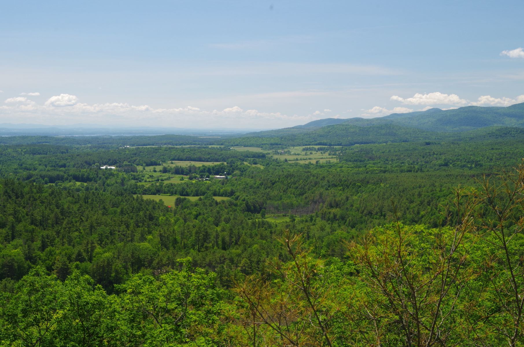
Hornbeam Hill: This is a 3-mile out-and-back, moderately strenuous trail that provides two outstanding views, one to the south toward the Westport hills and Lake Champlain and the other, a more intimate view of the small peaks within the Twin Valleys property.
Horseshoe Ledge: This 2-mile out-and-back trail leads to a stunning view of the Twin Valleys campus and the high peaks.
Payne Mountain: This is a 1.5-mile out and back trail, that after a steep and challenging climb, hikers are treated to one of the best views of the high peaks found in the Champlain Valley.
Twin Valley Loop: This is a 3-mile loop trail. It is the hub trail to all points in Twin Valleys. This wide and easily walked trail has a rolling quality and travels through all forest types. With good snow cover, it is an excellent Cross-Country ski route.
Whipple Mountain: This is a relatively easy 2-mile loop trail that travels through a lush landscape before reaching a viewpoint with a beautiful view of nearby pastures.
Directions: Click here for Google Maps directions.
Find this trailhead adjacent to the Twin Valleys Education Center at the end of Twin Valley Lane. To reach Twin Valley Lane, one must travel two miles from Wadhams on County 10 to Alden Road. Twin Valley Lane is ¼ mile up Alden Road. The gate to the Education Center is open on
weekends. When the gate is closed, one can park their car to the left of the gate, making sure not to block the gate. It is a half-mile walk along the access road to the Education Center. Accessing the property from the West Valley trailhead on Hurley Road is also possible.
(This trail can be found as T5 on the Central Champlain Valley CATS map)
Click here to download a printable map.