- Email : info@champlainareatrails.com
- Phone : (518) 962-2287
- Address : 6470 Main St., Suite 2 Westport, NY 12993
-
location
Essex, NY 12936
-
Category
Moderate

Boquet Mountain Trail
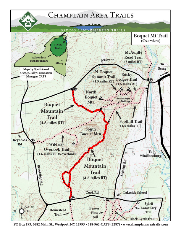
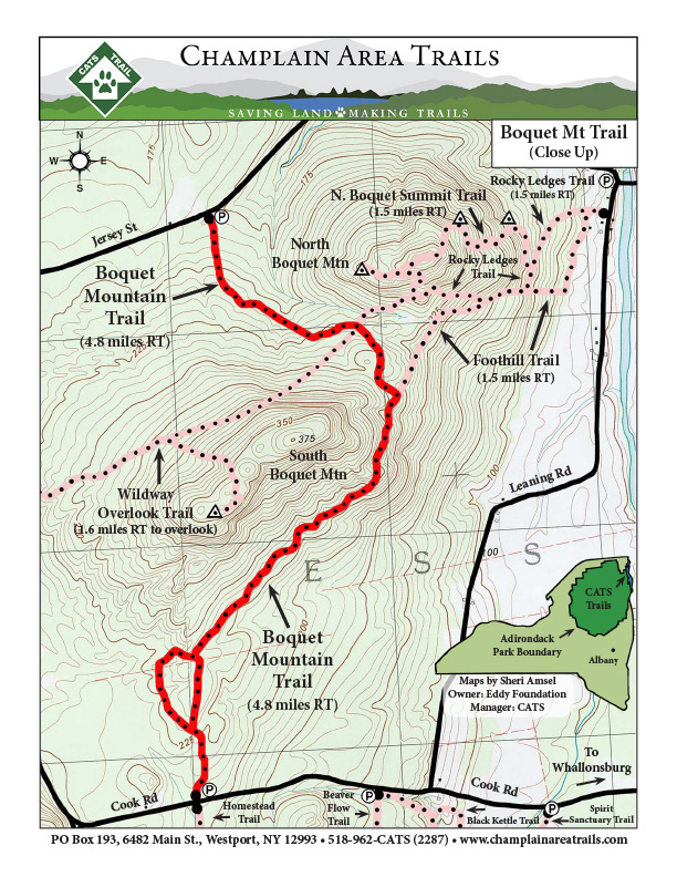
Description: The trail goes up to the saddle between North and South Boquet Mountains, traverses below the east side of the South Boquet Mountain through a biologically diverse oak-hickory-hornbeam forest, and then along an old logging road through mature forest to Cook Road, a seasonal road closed in winter. An easy yet very rewarding hike with views of Lake Champlain, the Champlain Valley, and the Green Mountains of Vermont across the lake.
Directions: Click here for Google directions.
Find the south trailhead on Cook Road, about ¾ mi west of Leaning Road. Find the north trailhead on Jersey St.,1½ mi west of the Boquet River.
(This trail can be found as B9 on the Central Champlain Valley CATS map)
Click Here To Download Printable Overview Map
Click Here To Download Printable Close-Up Map
 \
\
